
Munster ZIP Code Evidence
Official postal and town sources consistently support 46321 as Munster's primary mailing ZIP. The key caution is that no official public polygon or complete address-to-ZIP table was found. The USPS Domestic Mail Manual also prints a 46321 to 46322 Munster range, but that line is a postal labeling reference. It does not place every 46322 address inside town limits. Exact-address lookup controls.
| ZIP Code | Areas Covered | Post Office | Notes |
|---|---|---|---|
| 46321 | Primary mailing ZIP supported for ordinary Munster addresses | Munster Post Office | High confidence; exact address still controls |
| 46321-9997 | The Post Office facility at 917 Ridge Road | Munster Post Office | Facility-specific ZIP+4, not a residential range |
| 46322 | Appears in the USPS 46321 to 46322 Munster DMM range | Verify by exact address | Do not treat as an ordinary town-wide ZIP |
| Address-specific ZIP+4 | One delivery point or small address group | USPS exact lookup | No private test address was used in research |
The Munster Post Office is listed at 917 Ridge Road, Munster, IN 46321-9997, with phone 219-836-8005. The final four digits belong to that facility's listed delivery code. They must not be copied onto nearby homes. A reliable ZIP code directory keeps each claim tied to the official evidence and confidence level.
Verify a Munster ZIP Address
Use the USPS ZIP Code Lookup before attaching a mailing city, five-digit code, or ZIP+4 to a specific place. Search the complete street address as written on the mail. Save the returned format and lookup date. If the result conflicts with a map label, the USPS result controls the postal question while the town or county controls jurisdiction.
The USPS lookup screen below is the successful manifest capture for this Munster ZIP code directory.
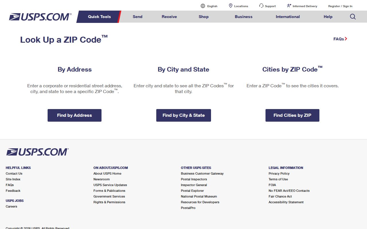
Its address-first workflow is the safe way to resolve the 46322 range caution, because the research did not establish a public ZIP boundary map.
Munster ZIP Search Fields
Different portals use ZIP in different ways. USPS verifies delivery data. The Indiana professional-license search and Business Search use ZIP as an optional location filter for public entities or credentials. Indiana Unclaimed also has city and ZIP fields, but it searches claims. Lake County XSoft exposes owner, address, and property number, not a ZIP field in the captured form.
| Source | ZIP-related input | What it returns | Limit |
|---|---|---|---|
| USPS lookup | Street, city, state, or ZIP | Postal format and address-specific ZIP+4 | Not municipal-boundary proof |
| Indiana PLA | ZIP with profession, name, city, county | Public license or facility result | Not a household list |
| Indiana SOS | Advanced city and ZIP fields | Business filing result | Entity address is not personal residence |
| Indiana Unclaimed | City and ZIP with name or property ID | Possible unclaimed-property record | Not a current address directory |
| Lake County XSoft | No ZIP field captured | Owner, address, or parcel search | Use exact address, not an assumed ZIP filter |
The screenshot from Indiana PLA verification shows a genuine ZIP-capable search.
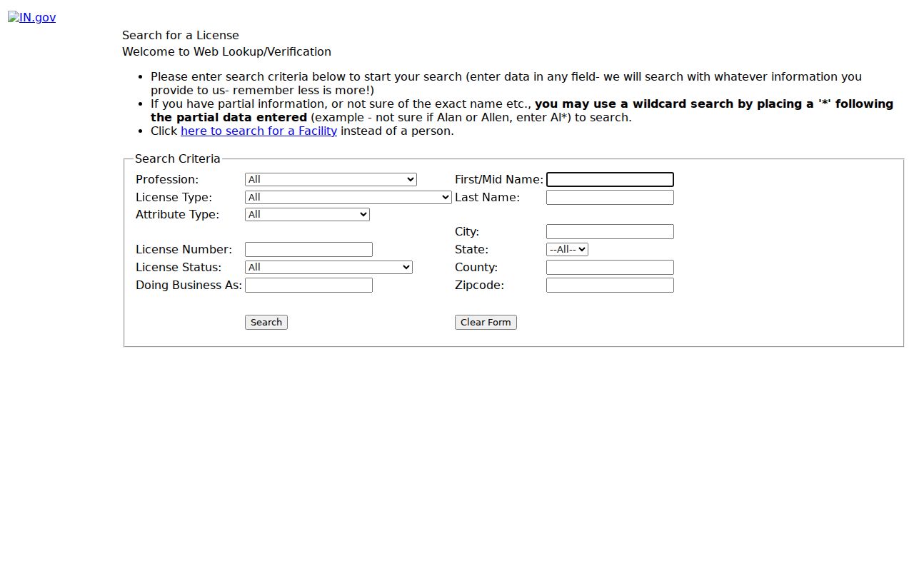
That field can narrow public credentials or facilities in Munster, but it cannot identify everyone living within the code.
Find Munster Residents by ZIP
Begin with a verified postal address, then select the public source that matches the question. A broad ZIP code search can narrow a license, entity, or claims database, but it will not yield a sound census of Munster residents. Property and voter sources also have tighter rules: XSoft searches a specific owner, address, or parcel, while Indiana Voters is designed for individual status and polling-place checks.
- Check the full address in USPS. Record the mailing city, five-digit ZIP, ZIP+4, and date returned.
- For a parcel question, search the exact street address in Lake County XSoft. Save the parcel number and separate site from mailing address.
- For a public credential or entity, enter 46321 in the PLA or SOS ZIP field and add a name or category. Treat the result as a license or filing only.
- For voter information, use Indiana Voters for the person's own status or polling place. Larger voter files require the proper county process and certification.
- Once a verified ZIP narrows the area, use the Munster street directory for address-level records rather than trying to infer a household from postal geography.
This sequence prevents one common error: using a postal code as proof that a person lives within the incorporated Town of Munster. Every result still needs its own office, date, and record type.
How Munster Assigns Addresses
Town building guidance says the building inspector assigns a number during the permit process and requires visible street-facing numerals. Rear numbers may also be required where an alley exists. For a new structure or disputed number, a permit or addressing record can be more useful than an old directory entry.
Munster Community Development and Lake County assessment records can confirm an address-to-parcel pairing. USPS confirms whether the address is deliverable and how it should be mailed. No one source proves the town boundary, zoning, ownership, occupancy, school area, or voting precinct. Ask each custodian only for the fact it controls.
Note: Preserve a parcel number exactly as shown; the source research did not publish a decoder for its individual segments.
What Munster ZIP Data Cannot Show
A ZIP result cannot establish who owns or occupies a home. It does not set a voting precinct, zoning class, school attendance area, utility district, or legal municipality. Those lines are maintained for different purposes and may cut through the same postal area. The Lake County assessor ties an exact address to a parcel record, the Recorder keeps land instruments, Munster Community Development keeps planning and permit material, and election officials control precinct information.
Population totals have the same limit. Census QuickFacts reports Munster's July 1, 2025 estimate at 23,504 and the 2020 Census count at 23,894. Those town-wide figures size the community, but they do not turn 46321 into a name-level resident roll. Even when a public portal accepts a ZIP field, read the result according to that database: a license, business filing, or unclaimed-property lead remains that type of record.
Can a mailing city prove jurisdiction? No. USPS assigns city names for delivery. Confirm the legal municipality through Town or county parcel and boundary records when that distinction affects the search.
Old Munster Addresses Before ZIP
ZIP codes are a modern layer, so they should not be forced onto early Munster records. Historic sources may identify Ridge Road, Calumet Avenue, North Township, a post office, a farm, an inn, or an earlier house number. Search the original wording first. Add a modern parcel or postal code only as a documented cross-reference.
The Lake County Public Library microfilm collection includes telephone directories from 1919 through 1942, census tools, newspapers, maps, and related material. Plat maps and Sanborn leads can bridge a place description to later streets. This is useful when a family or house appears before 46321 became part of its mailing identity.
Munster ZIP Record Fallbacks
The online route is not the only route. USPS answers delivery questions. Munster Community Development or Town Hall can address permit and building-number records. The North Township or Lake County assessor route can help with parcel pairing, and Lake County GIS may supply map context. LCPL and the Indiana State Library cover old street names and historic plans.
When a needed address or renumbering record is not online, request the existing town record by street and date under Indiana APRA. No official ZIP polygon, annexation chronology, E911 addressing page, or complete current Munster address-to-ZIP table was found. State that gap plainly. Do not draw a boundary from a commercial map or guess which nearby-city ZIP applies.
At a counter or by phone, give the complete address and say whether the question concerns mail delivery, parcel identity, a permit, a town boundary, or an old street label. For a written request, add the date range and ask for an existing record rather than a newly drawn ZIP map. Save the response and retrieval date. Postal and government pages change, and an undated screenshot is weaker than a dated answer from the responsible office.
Munster ZIPs Versus Town Limits
USPS states that ZIP boundaries do not necessarily follow city or town boundaries. A mailing city is delivery metadata, while the legal municipality and county come from government boundary and parcel records. For Munster, 46321 is strongly supported as the primary mailing ZIP, but it should not be treated as a perfect outline of the incorporated town.
The 46322 line in the USPS labeling range is the clearest local caution. It calls for exact-address verification, not a claim that two full ZIP areas lie within Munster. Nearby Hammond, Highland, Schererville, or other city names should never be substituted from visual proximity alone. A precise ZIP code directory keeps mailing, parcel, municipality, and service-area labels in separate fields.
- ZIP and ZIP+4
- A ZIP is the five-digit delivery area. ZIP+4 narrows the delivery point or small address group.
- PO-box ZIP
- A code used for post-office boxes rather than ordinary street delivery.
- Unique ZIP
- A code assigned to one large organization or facility.
- Carrier route
- A postal delivery path within a ZIP, not a town boundary.
Boundary check. Use USPS for mailing, Town or county records for jurisdiction, and parcel records for land. One result cannot replace the others.